Island Sedimentation, Sea Level Rise, and Coastal Resiliency
Project Lead: Mark Borrelli
Start Date: 2021
Summary
Sediment (sand and mud) moves from place to place due to flowing water and gravity. Understanding how sediment moves is important when thinking about how climate change and sea level rise may affect our beaches and coastal habitats.
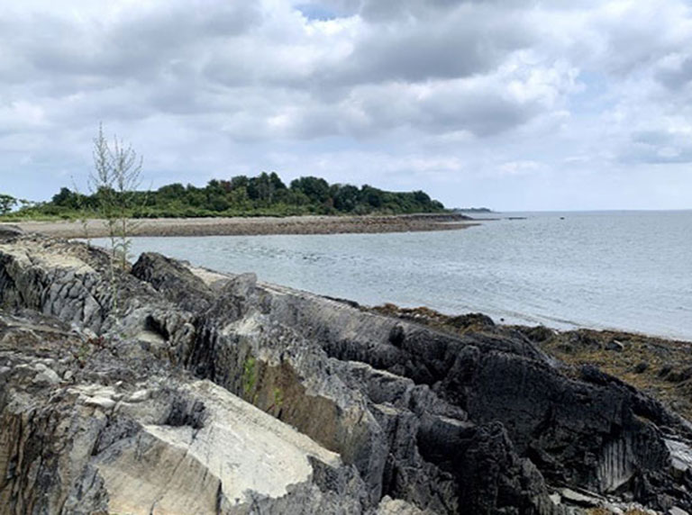
This project will study how sediment moves on and around Rainsford Island in Boston Harbor. The project will also examine how changes in season and storms affect how sediment moves. By looking at the changes to the sizes of the sediment, the speed and direction of currents and waves, and what is predicted in the future with climate change, we can better plan how to protect our coasts.
Background
Understanding sediment transport is critical to managing shorelines as climate changes and sea level rises, particularly along low-lying coastal areas. Rainsford Island, in Boston Harbor, has several distinct coastal sedimentary environments with regards to energy regime (tides and currents), geomorphology (shape of the shoreline) and sediment grain sizes. This effort will seek to document short (days) and long-term (years) trends with regards to sediment transport pathways, sediments sinks and sources, as well as the island’s geomorphological evolution as a result of coastal storms and sea level rise. The Stone Living Laboratory at Rainsford Island has an extensive network of in situ sensors and periodic drone overflights and seafloor mapping to map changes to the coast.
Research Objectives
This project will seek to use and augment those data to answer the four research questions discussed below.
What are the sediment transport pathways on Rainsford Island?
Using data from buoys, models, grain size analyses, drone flights and seafloor mapping, it will be determined where sediment comes from and where it goes. The role overwash (when high water levels wash over the low-lying parts of the island) plays on the shape of the island will also be examined to determine if this process results in a net gain (or loss) of sediment island-wide or along certain beaches.
Is there a seasonal signature in the sedimentary environments on the island?
Determining whether island beaches lose sediment in stormy weather and gain sediment in fair weather provides useful information when coastal development is being considered or designed.Whether island beaches function like seasonal pocket beaches, can also impact coastal adaptations all around Boston Harbor and beyond. Most beaches have sand transported along the shoreline. Sand starts on one beach and ends up on another as the sand continues to move along the coast. Pocket beaches keep most of their sand. The sand moves offshore during storms and slowly back onshore during fair-weather. It doesn’t share sand with other beaches.
How do coastal storms alter the shorelines of the island?
This study will focus on the effect of extratropical cyclones (e.g. Nor’easters) and less frequent tropical cyclones (tropical storms and hurricanes) on the Island. As storms are predicted to increase with climate change, it is important for us to understand the importance of these storm events.
Has Rainsford Island historically (19th to early 21st century) kept pace with sea level rise?
Using available maps and charts from the 1800s to the present, the geomorphology of the island and nearshore area will be examined within the context of sea level rise. These data coupled with findings from our other work will help us understand whether the Island has kept pace with sea level rise and how it may respond with future sea level rise. Coastal areas can increase in elevation as sand gets deposited in low-lying areas. If that deposition increases the elevation of the island fast enough than coastal areas can ‘keep pace’ with sea level rise.
Methodology
To quantitatively assess island sedimentation and morphodynamics, three types of data must be collected: 1) oceanographic (water level, wave, tides and currents); 2) geomorphologic (terrestrial and marine); and 3) sedimentologic (grain size). It will be critical to document the drivers of coastal change as well as the impacts they have on the geomorphological and physical characteristics of the island.
Schedule
This project extends from 2021-2024.