Participatory Science for Boston Harbor
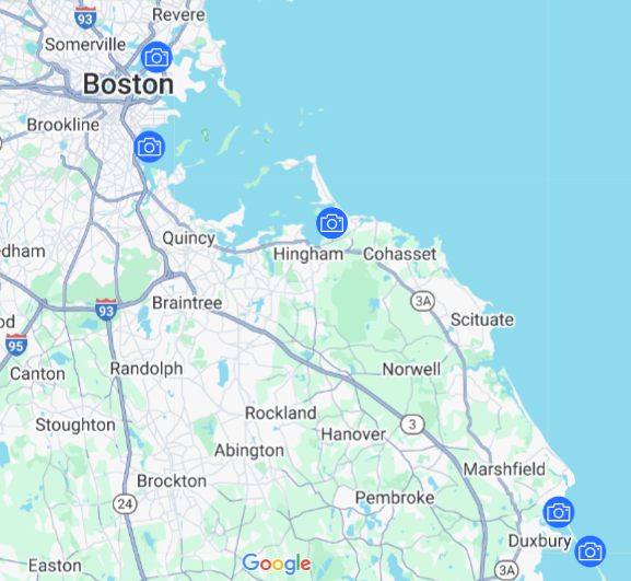
Stone Living Lab has partnered with Chronolog to establish five monitoring sites around Boston Harbor and Duxbury Beach. Using images submitted by visitors, residents, and passerby alike, we are assembling timelapse imagery of coastal change around the waterfront. With this kind of long-term data, we can see how normal coastal change and extreme events alike are impacting our communities.
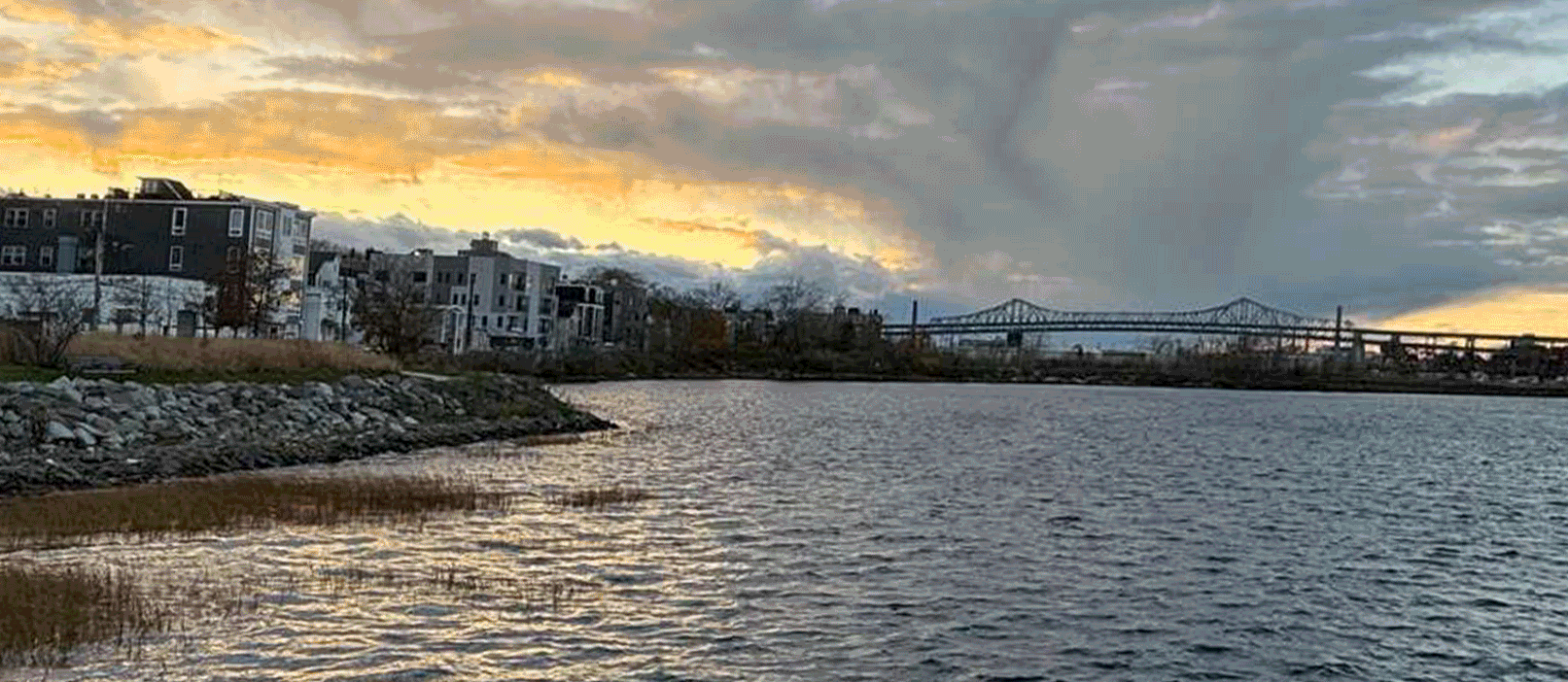
Featured Site: Condor Street Urban Wild
Located in East Boston, this unique park is part of the City of Boston’s Urban Wilds program. This area features walking trails, native plantings, and a small salt marsh. It is also the future site of the Lab’s Living Seawalls pilot program, as well as an upcoming salt marsh restoration project. With over a year’s worth of imagery, we can see how the salt marsh grows and shrinks seasonally, and how local pressures affect this space! View the full timelapse here.
Explore our other sites!
Fallon Pier
Damde Marsh
Powder Point Bridge
Duxbury Beach