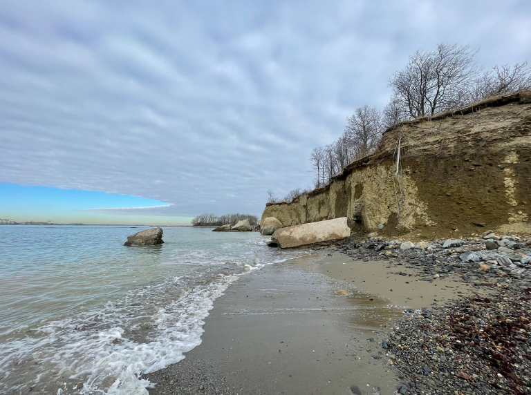
Learn more about Lovells Lovell’s Island Bluff
The Boston Harbor Islands are one of the few partially drowned drumlin fields in the world. These unique islands were formed more than 10,000 years ago as glaciers migrated north during the last Ice Age. The islands themselves are made up of glacial till, a combination of hard bedrock, crumbly sand, and small cobblestones. Over time, the islands have shifted and eroded in unique ways.
Lovells Island is a great example of how some of the islands have eroded into steep cliffs, or bluffs. The island is composed of three drumlins made of easily eroded sediment. As the sea level continues to rise and storm waves become more powerful, this erosion will likely speed up. Researchers are studying the erosion of many of the islands in Boston Harbor to find out more, and help guide decisions on how to adapt to new conditions.
A study done by Black et al. in 2025 used aerial photos and Lidar analysis to find that the northern bluff on Lovells is retreating at about 1.5 ± 0.4 m/yr. This is the highest rate of retreat across all of the Boston Harbor Islands.
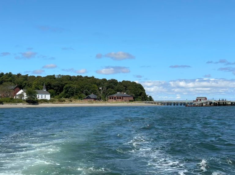
Take a Peek at Peddocks Peddocks Island
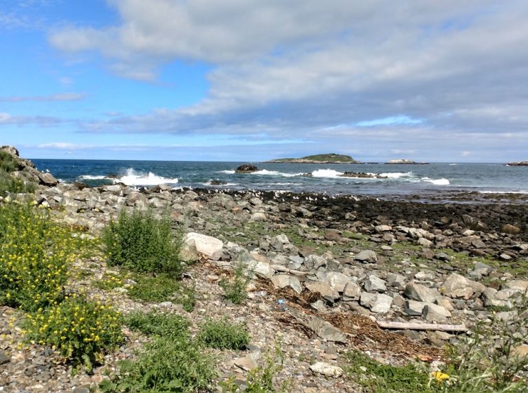
Peddocks Island is one of the largest islands in Boston Harbor. The largest drumlin, called East Head, is only 1/10th of a mile across the water from Hull – but don’t try to swim across! The channel between Peddocks and Hull, called the Hull Gut by locals, is the fastest channel of water in Boston Harbor.
Peddocks Island consists of five drumlins connected by two low lying sand flats called tombolos. Drumlins consist of unconsolidated clay, sand, gravel, cobble, and boulders all mixed together (also known as known as glacial till). As the glaciers moved, they carved out the “upside-down spoon” shape that we see today.
Tombolos are sand spits that connect islands to each other or the mainland. They are formed by longshore drift, a process where wave action and currents push sediments parallel along the shoreline. Some tombolos on Peddocks now frequently overwash in flood tides. In the coming decades, could Peddocks Island become multiple islands?
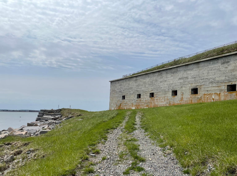
Get to know Georges Georges Island Seawall
Georges Island is one of the most visited islands in the Harbor. During the summer months, visitors can explore the historic fort, hear about some of the supernatural legends on the island, watch a vintage baseball game, or enjoy a picnic with some of the best views in Boston! As time and the changing climate affect the island and its infrastructure, you can also see how the island is changing from year to year.
In years past, colonists and settlers focused on building seawalls and hardened shorelines to protect coastal areas and build permanent infrastructure. However, these seawalls eventually need repair and can actually cause worse erosion downshore. How can managers help prepare visitors and the island for a changing future?
On the east side of the island there is a seawall made of cobblestones that is meant to protect the island against erosion. However, due to the continuous wave action, the seawall is continually being eroded and needing to be rebuilt. Is cobblestone the best material to use?
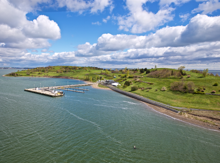
See Spectacle Spectacle Island
The flagrant abuse of the islands and harbor that started with colonists, and continued through industrial and military use, eventually took a toll. By the 1980s, Boston Harbor was deemed one of the dirtiest harbors in the country. Long-time residents of Boston still remember the foul smell of low tide, the brown froth kicked up by passing boats, and trash littering the beaches.
From 1935-1959 Spectacle Island served as the city’s official municipal dump. With little protection, the trash was free to blow directly into the surrounding harbor, polluting the waters. It was hard to imagine a thriving Boston Harbor – but in the 1980s, community action forced the City of Boston to begin a massive cleanup effort to reshape the harbor. As part of this effort, Spectacle Island was rehabilitated from a historic trash dump to the park’s most-visited island, hosting more than 30,000 people each year. The harbor is now a landscape of sparkling water and vibrant island habitats – though there is still much work to be done.
The 411 on Floods Flood Monitors
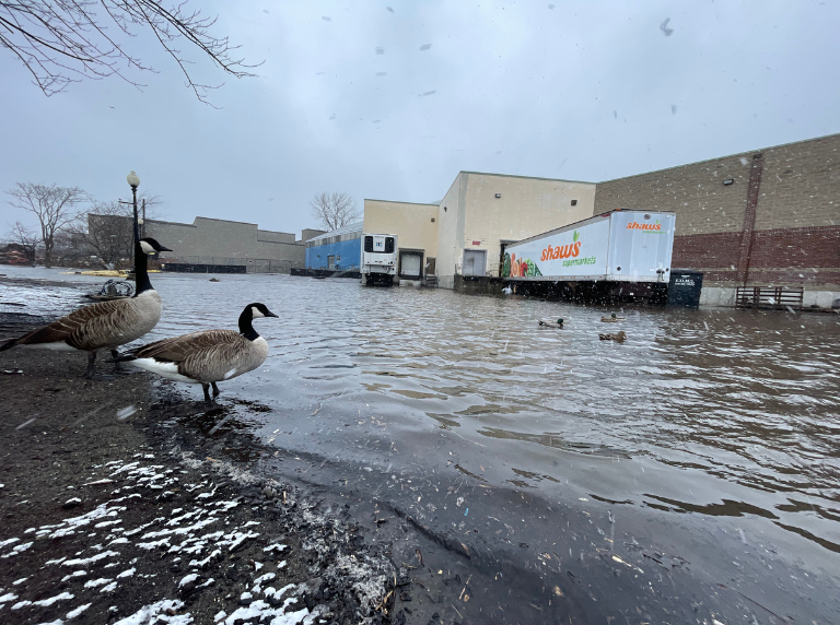
The ocean has risen over 10 inches in Boston in the past 100 years. On days with extra high tides, many areas of the city flood. It can be even worse during storms. Boston residents have known for years about local flooding events that happen during extra high tides or powerful storms. Parts of the city, including East Boston, Dorchester, and Downtown Boston, now flood more regularly than they did in the past, and will continue to do so as time marches on.
The Lab’s Real-time Monitoring in Boston Harbor project – launched in the fall of 2023 in partnership with Woods Hole Group and the City of Boston – provides real-time monitoring of waves, water level, and meteorological parameters in and along Boston Harbor through the use of Hohonu overland flood sensors, which record flood depths in real-time, giving scientists, city officials, and the public this data for the first time. This kind of new, immediate data will help Boston prepare for flooding events, and provide important information to residents and businesses along the shoreline.

An Eye on the Islands Boston Light Webcam
On Little Brewster, there are four cameras, taking photos every minute. Photos can additionally be saved so that weather phenomena and changes to wave energies can be observed over a given time span (such as a snowstorm or astronomical high tide).
The outer islands (Calf, Great, Middle and Outer Brewster) absorb the highest wave energies from the ocean, shielding the inner harbor islands and mainland Massachusetts from the open ocean.
However, with this continued wave action paired with the soft and loose sediment that make up the islands, the outer islands are susceptible to high rates of erosion. This can lead to shrinking island size, allowing for stronger waves reaching the mainland. This can ultimately affect the local communities with increased property damage and flooding.
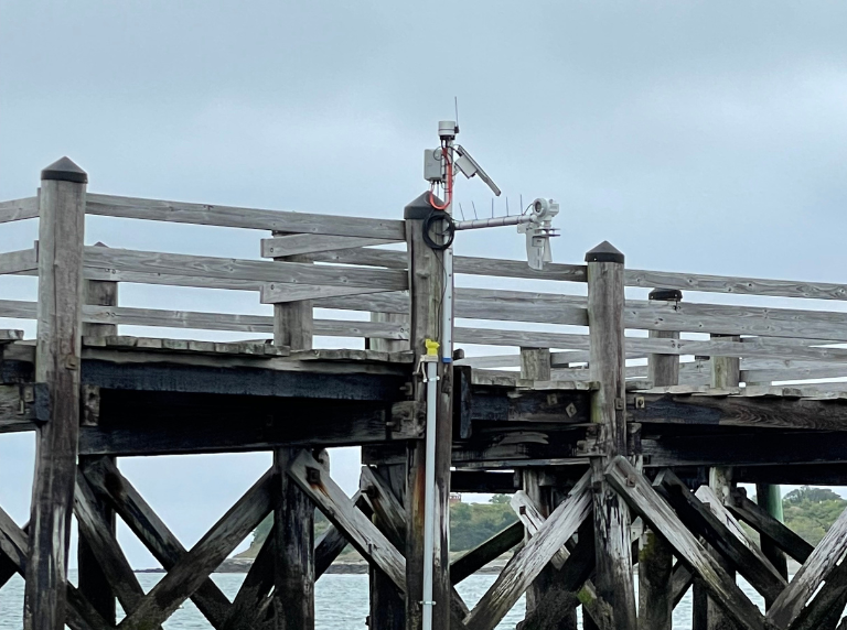
Take a gander at Gallops Gallops Tide Gauge
By measuring the actual tide heights every day, we can make our scientific models even more accurate. We can also see what kinds of tides most impact Boston. As Boston prepares for climate change, we need to collect data on what is currently happening in the Harbor! By measuring current conditions (the baseline) we can observe how things may change in the future.
The Gallops Island tide gauge measures the height of every high and low tide. Scientists can predict what the tide heights should be, but weather conditions can change them – especially during storms.
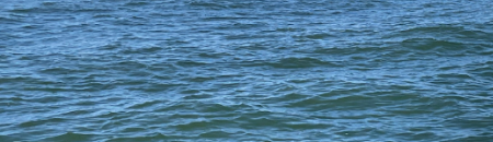
Riding the Waves Harbor Wave Buoys
Wave buoys are floating instruments that use sensors to measure components of waves. Stone Living Lab has three wave buoys that are constantly taking measurements. The buoys are at Gallops Island, the northeast shore of Rainsford Island, and the Boston Harbor entrance. The Stone Living Lab wave buoys measure wave height, water current speed, and wave direction in the outer harbor. We can also compare the outer harbor to the inner harbor!
As Boston prepares for climate change, we need to collect data on what is currently happening in the Harbor! By measuring current conditions (the baseline) we can observe how things may change in the future. As scientists carry out experiments to help Boston prepare for climate change, we can compare results to this baseline information.
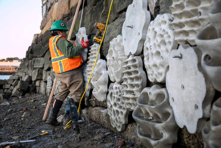
It's Alive! Living Seawalls
Boston has 47 miles of coastline, most of which is covered by cement or hard shorelines. This makes it easier to build buildings, but also means that the city is vulnerable to flooding and has very little habitat. In partnership with Living Seawalls from Sydney, Australia, the Stone Living Lab installed two pilot Living Seawalls in Boston – the first sites in North America!
These 3D printed panels provide new habitat for nature marine creatures, and may help slow down waves and improve water quality. How can this kind of innovation help Boston reimagine what an urban coastline looks like?
Coming home to Calf Island Nesting Birds on the Islands
Sea level rise is a major threat of declining seabird populations. Boston Harbor is expected to have nine inches of sea level rise according to every sea level rise prediction, flooding the salt marsh and coastal areas on Calf Island. Gulls and shorebirds tend to nest in these areas, and will therefore face extreme loss of suitable nesting areas.
During the summer, the National Park Service monitors coastal breeding birds. Eight of these species nest on Calf Island’s shrubland, rock cliffs, and sandy beaches. The species are then broken into five groups, Cormorants (Double Crested), Ducks (Common Eiders), Gulls (Herring and Great Black-Backed), Shorebirds (American Oystercatcher), and Waders (Great Egret, Snowy Egret, and Black-crowned Night Heron).